WATER, THE FLUID OF LIFE: The Rivers of Path of the Tapir Biological Corridor
By Jack Ewing

I used to think of geology as the study of rocks and geologists as scientists who sit in laboratories looking at rocks with a magnifying glass. Sound boring? I used to think so until found out how much geological events have influenced my life. One day I got interested enough to dig a little deeper and found that geology, rather than being boring can be fascinating, especially when we consider how much certain geological features of the region around Dominical have affected the way that the area has developed. I am referring primarily to coastal ridge, that small mountain range that parallels the coast from the Savegre River to the Térraba River. In the not too distant past — less then 100,000 years ago — a collision between two tectonic plates caused the earth’s crust to buckle and jut up 300 to 500 meters in the air. This probably wasn’t a cataclysmic event that took place one afternoon. It was more like a series of relatively small collisions that took place over several thousand years. Nevertheless, in geological terms we can consider that it happened in the blink of an eye.

Farther inland something caused the earth’s crust to split. The land on one side of the split rose, and on the other side it dropped until there was a difference of about 300 meters in the altitudes of the two sides. Today we call the top of that split the Tinamastes ridge. It is not clear if this phenomenon came into being at the same time and due to the same geological pressures as the coastal ridge or if the two events happened independently. It is possible that the coastal ridge is younger than the Tinamastes ridge, but a great deal more study will have to be done to determine these details.
Today, this area from the Savegre River to the Grande de Térraba River and from the Pacific coast to the Tinamastes Ridge is called the Path of the Tapir Biological Corridor (PTBC.) It is composed of about 20 nature reserves about half of which have some form of official recognition or formal declaration as reserves. Once the PTBC is complete all of the reserves will be connected by corridors of natural habitat. One of the more interesting aspects of the corridor is the number of rivers that originate within its bounds. Both of the two boundary rivers, the Savegre to the northwest and the Térraba to the southeast originate outside of the corridor. But, there are 10 smaller rivers whose head waters are located between the coastal ridge and the Tinamastes ridge. Each of these rivers has a water shed or basin which drains into a multitude of streams and rivulets that flow into the these 10 rivers. It would be reasonable to say that 75% of the PTBC is composed of these watersheds all of which collect rain water which provides potable water for the 52 communities of the PTBC. Let’s have a closer look at that extremely important source of life giving liquid.
If you take a cutting board, hold it at an angle and pour a glass of water on top of it, the water will run off immediately. If you glue a piece of foam rubber to the cutting board and pour the water onto the foam, it will absorb and flow out slowly over a period of several minutes. This is exactly what happens in a water shed. Where the land has been deforested could be compared to the cutting board. All the rain water runs off immediately flooding the rivers and streams. Little water is retained in the earth, and the free flowing springs all dry up early in the dry season. Where there is forest the rain water filters down slowly through the various layers of canopy, is retained in the vegetation, leaf litter, humus and soil and released slowly. The rivers don’t flood, and in many cases the springs flow during the entire dry season. As this region develops, and more people come here to visit and live, water will become more and more important, and watersheds with healthy forest cover are the key to a reliable supply of water for human use.
Let’s have a closer look at these rivers and their watersheds. If you have a map of the area, you may want to refer to it while reading this next section. Beginning at the northwestern end of the Path of the Tapir Biological Corridor, we have the Savegre River, which originates near the Cerro de la Muerte and flows rapidly down along the southeastern edge of the Los Santos Forest Reserve. It is joined by the Division River just below the village of Brujo and continues on forming the boundary between the PTBC and the Los Santos Forest Reserve. The Savegre is popular for white water rafting in the stretch that flows past Brujo, Rafiki and Santo Domingo, but has leveled off considerably by the time it reaches the town of El Silencio. A large mangrove estuary flows lazily southeast from the mouth of the Savegre and joins the mangrove estuary that extends northwest from the mouth of the first river that originates within the PTBC, the Portalón.
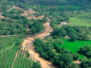
A mere five kilometers to the southeast of the mouth of the Savegre the Portalón river empties its waters into the estuary and the Pacific Ocean. As are most of the rivers in the PTBC, the Portalón is fairly short springing to life near a place called Las Nubes at about 700 meters above sea level. In late September of 2005 a torrential rain storm hit this area. Mud slides full of tree trunks from up river clogged the Portalón just above the village and cause it to overflow its banks. The town was completely flooded and literally disappeared off the map. It has since been rebuilt nearby, but farther from the river. Deforestation and road building on the slopes of the Portalón watershed played a role in this tragedy.
The head waters of the Hatillo Nuevo river, like the Portalón originate at about 700 meters of altitude, but about 9 kilometers farther to the southeast between Las Nubes and the Tierras Morenas ridge. Part of its waters flow into a large mangrove estuary at the mouth. Another river, the Cascadas, flows into the Hatillo Nuevo about six kilometers above the mouth.
At less than eight kilometers long, the Rio Hatillo Viejo is the shortest river in the PTBC, and also the lowest. It springs to life at only about 350 meters above sea level, near Lagunas ridge. It feeds a mangrove estuary which extends about one kilometer inland from the river mouth, parallel to Playa Guapil.

Continuing to the southeast across the six kilometers of Guapil and Barú Beaches, we find the mouth of the longest river in the the PTBC with the largest watershed. If we begin looking above San Juan de Dios we will find the Caña Blanca River, which flows into the Guabo River, which in turn joins the Barú at the village of Barú. If we move from San Juan de Dios about ten kilometers to the southeast to the the basin where Las Tumbas and El Salvador are located we find the river system that feeds the major arm of the Barú. This is formed by two rivers, the Diamante and the Barucito. The Diamante, in turn, receives a large portion of its flow from the Torito River. The head waters of the Barú River are located near the village of La Florida between the Tinamastes ridge and the Alivio ridge, at about 700 meters above sea level and around 20 kilometers above the point where it empties into the Pacific Ocean.
In view of the complexity of the the Barú River system and its extensive watershed it is interesting to note the origin of the name “Barú.” According to the linguistics department of the University of Costa Rica, the word “barú” comes from the indigenous language Guaymi which is still spoken by the people of that tribe. I once met two native Guaymi speakers, both of whose Spanish was very basic. I asked them about the meaning of the word “barú.” Although the exact translation of the word is not entirely clear, the meaning appears to be similar to that of the English words meaning “river basin” or “watershed.”
Between the Barú River and the Higueron or Morete River, The coastal ridge comes very close to the sea, and no rivers cut through it. However, five streams of up to five kilometers long, originate on the slopes of the ridge and quickly empty their waters into the sea. Beginning in Dominicalito and moving southeast these streams are the Pozo Azul, Diablo, Peje, Puerto Nuevo, and Playa Hermosa. Then we come to the Morete River.
All of the maps of Costa Rica for the last 150 years show this river as the Higuerón. Nevertheless, about 50 years ago, a man named Morete drowned on the river, and the local people began calling it the Morete River. Today, if you ask for the Higuerón River in Uvita, most people won’t know what you are talking about. This river has the distinction of beginning its course from the highest point of any other river in the corridor, 920 meters above the sea on the upper slopes of the Alivio ridge.
The Rio Uvita is joined by the Cortezal and Ballena Rivers less than five kilometers from where it empties its waters into the Ballena Marine National Park. It also feeds a mangrove estuary which is united with the estuary that extends southeast for the Morete. Though it is short compared to the Baru, the Uvita has a tremendous flow and a large water shed.
South of Uvita the coastal ridge once again runs close to the coastline, not allowing any rivers to break through until Playa Tortuga nearly 15 kilometers to the southeast. The rain that falls in this stretch feeds seven streams that run quickly into the sea. Beginning in Uvita, these streams are the Colonia, Grande, Ballena, Simon, Mercedes, Piñuela and Ventanas. All originate on the coastal side of the ridge.
If that 15 kilometers is lacking in rivers, the next five make up the difference. Beginning at Tortuga Beach, both the Tortuga and Balso rivers empty their waters into the same estuary and practically the same mouth. Less than one kilometer up stream the Media Luna River empties into the Tortuga. Three kilometers farther the Punta Mala River flows into the very mouth of the Grande de Térraba River as does the Coronado River, only two kilometers further on.
The Grande de Térraba River marks the southeastern boundary of the PTBC. Perhaps it’s most interesting feature is the tremendous mangrove estuary at the mouth which joins together with that of the Sierpe River. This may be the largest mangrove system in Central America. In the next few years a very large hydroelectric project called the Diquis will be built on this river near Buenos Aires. This will provide electrical energy for much of Central America, but will greatly affect the ecology of the river.
To sum it all up, we have ten rivers that come to life within the Path of the Tapir Biological Corridor and empty their waters into the Pacific Ocean, the Portalón, Hatillo Nuevo, Hatillo Viejo, Barú, Morete, Uvita, Tortuga, Balso, Punta Mala and Coronado. Additionally there are seven secondary rivers that flow into these; the Cascada, Guabo, Diamante, Barucito, Cortezal, Ballena and Media Luna. Finally in the Barú river system there are two tertiary rivers that flow into the secondary rivers, the Caña Blanca into the Guabo and the Torito into the Diamante. That makes a grand total of 19 rivers that come to life in the PTBC, all between the coastal ridge and the Tinamastes ridge, and all of whose waters eventually end up in the sea within the boundries of the corridor. Keep in mind that this is in a area that is only about 70 kilometers long and 15 kilometers wide. Every one of these rivers, large or small, has its own water shed, and all are important for the ecological health of the corridor and the assurance of a reliable water supply for the communities of the PTBC.
In an interesting side note, I came across a map of Costa Rica from the year 1868. Only seven of these rivers are shown on it, the Hatillo Nuevo and the Hatillo Viejo (with the name Hatillón,) the Barú (which is shown to be larger than the Savegre,) Dominical, Higueron (now called Morete,) Punta Mala, and Coronado. On this map what is today classified as a stream, the Pozo Azul, was called the Dominical River. The map showed a place called Portalón, but it showed it being located beside the Savegre and had no separate river for the Portalón.
I can’t over emphasize the importance of maintaining and improving the health of these rivers and their respective watersheds. The health not only of our rivers and streams, but also of our mangroves, oceans and most importantly our communities depends on it. In the coming months and years the Amigos de la Naturaleza del Pacifico Central y Sur (ASANA) will be putting a great deal of effort into numerous activities designed to accomplish these goals. Among other things we will be working with the local water associations called ASADAS. Last month I talked about the assault on the Barú River by gravel mining companies and the plight of the neotropical river otter. If any of you readers observe otters on any of the rivers or streams in the PTBC, please write me at [email protected] and let me know. The presence of otters is a very good indication of a healthy river. In the future we will talk more about protecting the rivers from those who would damage their health, and also about methods and programs for making improvements. It is a theme that affects us all.

thank you jack, this kind of detail description is much needed for those of us who love Costa Rica. i can’t wait for our next trip, maybe we will get to explore some of the PTBC. see ya tom
+1
thank you jack, this kind of detail description is much needed for those of us who love Costa Rica. i can’t wait for our next trip, maybe we will get to explore some of the PTBC. see ya tom